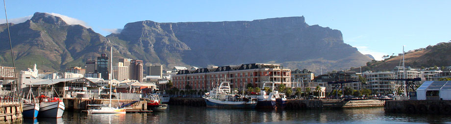
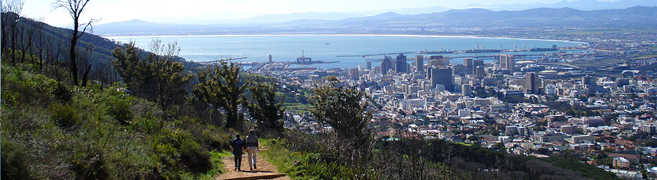
Cape Town Walks & Hiking Trails
206 results for Cape Town. Narrow these results to find the most suitable tour for your holiday, using the filters provided (right hand column).
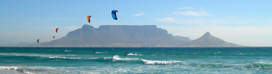
Muizenberg Moonlight Meander
Where? Meet in front of Knead Bakery, Surfers Corner, Muizenberg, False Bay Coast, Cape Town

The beach of Muizenberg is about more than the endless stretches of white sand, the azure waters that lap these shores, and the high African skies overhead. It is about the thrill of watersports, the wonder of the sharks and ...
More \ View Full Details
Murludi Hiking Trail
Where? Murludi fruit farm, Tulbagh, Breede River Valley, Western Cape, South Africa
The Murludi Hiking Trail consits of various walking trails in the northern part of the Tulbagh Valley. The wine valley is a stunning site, but especially from a height on the hiking trails.
Enjoy crossing mountain streams, ...
More \ View Full Details
Myburgh's Waterfall Ravine Trail
Where? Start at Farriers Way (a cul de sac off Hunters Way) in Hout Bay and finish at Suikerbossie restaurant.
Start: Farriers Way (a cul de sac off Hunters Way)
Finish: Suikerbossie restaurant
Duration: 8 km, roughly six hours
Fitness: moderate to fit
Our tip: best to do the hike in winter if you want to see the waterfalls, however ...
More \ View Full Details
Newlands Forest Contour Path
Where? Newlands Forest Station, Newlands, Cape Town
The Newlands Forest Contour Path is a manageable, 8km long walk through Newlands Forest. It offers quick access to a natural environment and has wonderful views - one could almost forget one is still in the city!
The walk ...
More \ View Full Details
Orange Kloof Hike
Where? Start and finish in the Constantia Nek parking area in Constantia, Cape Town.
Start: Constantia Nek parking area
Finish: where you started
Duration: 8 km, roughly 5 hours, but you can adapt the hike to suit your group
Fitness: you need a good pair of boots and a fair fitness as there is quite a climb ...
More \ View Full Details
Oude Skip Hike
Where? Start and end in Eustegia Way, Hout Bay, Cape Town
Start: Eustegia Way, Hout Bay
Finish: Eustegia Way, Hout Bay
Duration: as long as you want it to be
Fitness: moderate to easy
Our tip: this is part of the Karbonkelberg Traverse, a seven-hour difficult trail that connects ...
More \ View Full Details
Outeniqua Hiking Trail
Where? 1-7 days long, depending, 108 kms altogether
Nestled in the lush, verdant landscapes of the Garden Route, the Outeniqua Hiking Trail is among South Africa's most cherished and oldest hikes, renowned for its diversity in flora, fauna, and natural beauty.
This seven-day ...
More \ View Full Details
Pakhuis Trail
Where? Start and finish at the Pakhuis Pass near Clanwilliam, Cederberg
Start: Pakhuis Pass
Finish: Pakhuis Pass
Duration: 3 nights, 4 days, 40 km
Fitness: moderate to difficult; whilst there is no scrambling involved there are steep mountain hikes and uphill walking involved
Our tip: a wonderful ...
More \ View Full Details
Pakhuisberg Day Walk
Where? Start and finish at the Kliphuis campsite, Cederberg.
Start: Kliphuis campsite
Finish: Kliphuis campsite
Duration: 13 km
Fitness: moderate to difficult
Our tip: This is one of the routes mapped on the new version of the Peter Slingsby Hike The Cederberg map (northern ...
More \ View Full Details
Peers Cave Hike
Where? Fish Hoek, False Bay Coast. See detailed directions below.
Most people get to Peers Cave, above the dunes of Fish Hoek, in a fairly dignified manner, albeit a steep one. There is, after all, a fairly logical and easy to find path hewn for hikers that leaves a parking lot on Ou Kaapse ...
More \ View Full Details
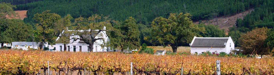
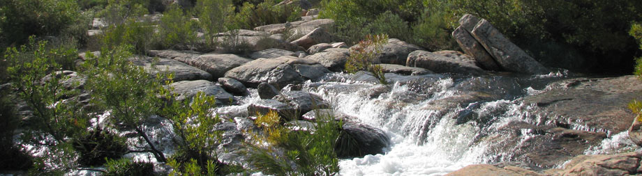
Picnic at Doolhof Wine Estate
Where? Doolhof Wine Estate, Bovlei Road, Wellington, Cape Winelands
Meandering through Doolhof Estate is the picturesque Kromme River. The River Walk, which was created in 2007, allows visitors to enjoy the scenic views on offer at Doolhof. One can follow the meandering path for several ...
More \ View Full Details
Piet Barbet Trail
Where? Oudtshoorn, Karoo, Western Cape, South Africa
When one pictures hiking trails in Oudtshoorn, one usually thinks of stark Karoo landscapes and dry landscapes but the 4.1 km Piet Barbet Trail takes hikers through the subtropical thicket of the Gamkaberg Nature Reserve. ...
More \ View Full Details
Pieter Cruythoff Route Trail
Where? Bothmanskloof Pass, Riebeek Valley, Swartland, Western Cape
Start: stile to the north of the memorial on Bothmanskloof Pass
Finish: back where you started
Duration: 2, 3 hours
Fitness: moderate
Our tip: you should have permission from Meerhof farm to do this hike
This route is ...
More \ View Full Details
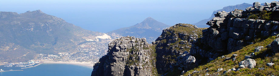
Platteklip Gorge Hike
Where? Platteklip Gorge Hike, Kloof Nek, City Bowl, Cape Town, South Africa
Table Mountain is Cape Town's very own natural wonder. Its flat top and gorgeous rocky faces stand watch over the Mother City in elegant silence, beckoning explorers to experience the beauty of the Western Cape from new heights. ...
More \ View Full Details
Porcupine Ravine
Where? Porcupine Ravine hike up Table Mountain, Start at the Pipe Track, Theresa Avenue, Camps Bay, Atlantic Seaboard, Cape Town, South Africa
Start: the Pipe Track, Theresa Avenue, Camps Bay
Finish: Theresa Avenue
Duration: half a day, although take a picnic and make a day of it
Fitness: fit
Our tip: don't venture up the mountain face without proper food, water and ...
More \ View Full Details
206 Results for Cape Town
Filter the results to find your perfect activity